SPE Southwest/West Tahoe CoLab

Back in college, I attended the National Society for Photographic Education conference in Newport, Rhode Island. I don't remember much about it, except that Frank Gohlke, one of my favorite photographers, was the Keynote Speaker, and that the portfolio reviews helped me grow a lot.

I have since attended a few other National and Regional (now Chapter) conferences, but until this last Chapter conference in Tahoe City, it had been 9 years since the National one in Denver since I had been to a conference. Even though I'm not in Academia at all, I started wanting to go to a conference last year. The National conference this year was in Orlando, and it would have been too expensive for me to go out, but I decided to just plan on going to the Chapter conference, wherever it was going to be held in the Fall. Once the details were announced for the Southwest Chapter and registration opened up several months before the conference was to be held, I was quick to register.

At that moment, it seemed like the dates for the conference were so far off. But the day finally came, and we three loaded up the car—well, Gina and I did; Tommy didn't do anything to help pack the car, the little freeloader—and headed out West. We planned on going as far as Elko, Nevada, which is about half way between Logan and Tahoe, to give our little guy a break from his car seat, since he doesn't like being contained for long periods of time (read: periods longer than 15 minutes). But, to his credit, he actually travelled really well both on the trip out and the return trip.

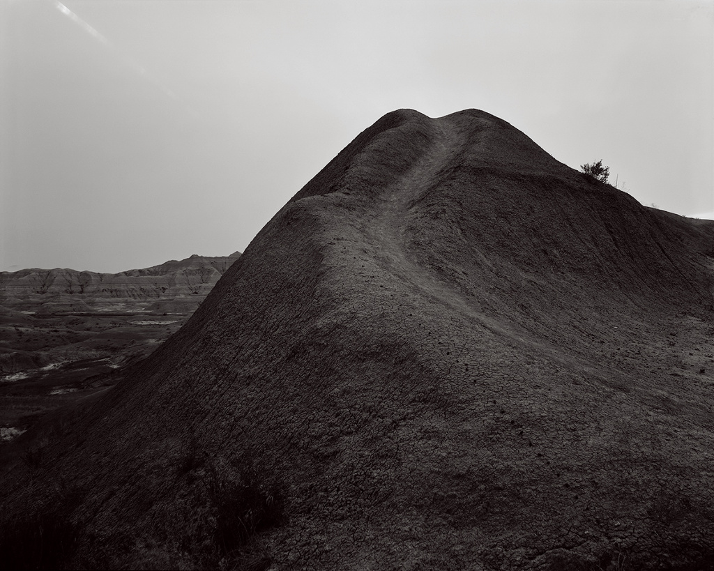
After a night of terrible sleep for all three of us in a Casino Hotel, due to the cigarette smoke that had permeated throughout the entire building, we hit the road again. We made a couple of pit stops, one of them at a rest stop in western-ish Nevada, where Tommy got to crawl and play in (and eat) the gravel:

Tommy playing in the gravel at a rest stop

Tommy playing in the gravel at a rest stop

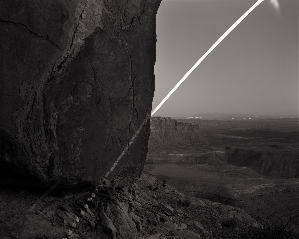
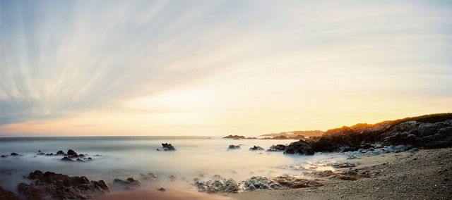
We finally arrived at the Granlibakken Resort at around 3 on Friday. We checked in to our room and got settled in a bit, and then I went and made a few photographs of the Truckee River, and Lake Tahoe before the conference got underway.

William B. Layton Park, Lake Tahoe, California 2017

William B. Layton Park, Lake Tahoe, California 2017

Harrell Fletcher was the main speaker at the conference, and he gave a great speech, covering all of the collaborative work that he's done throughout his career.

Saturday morning was full of short presentations by a number of artists, including one by a friend, Bryon Darby, who presented his New Farmers project, a collaborative body of work on contemporary farmers in Kansas.

Bryon Darby presenting New Farmers

Bryon Darby presenting New Farmers

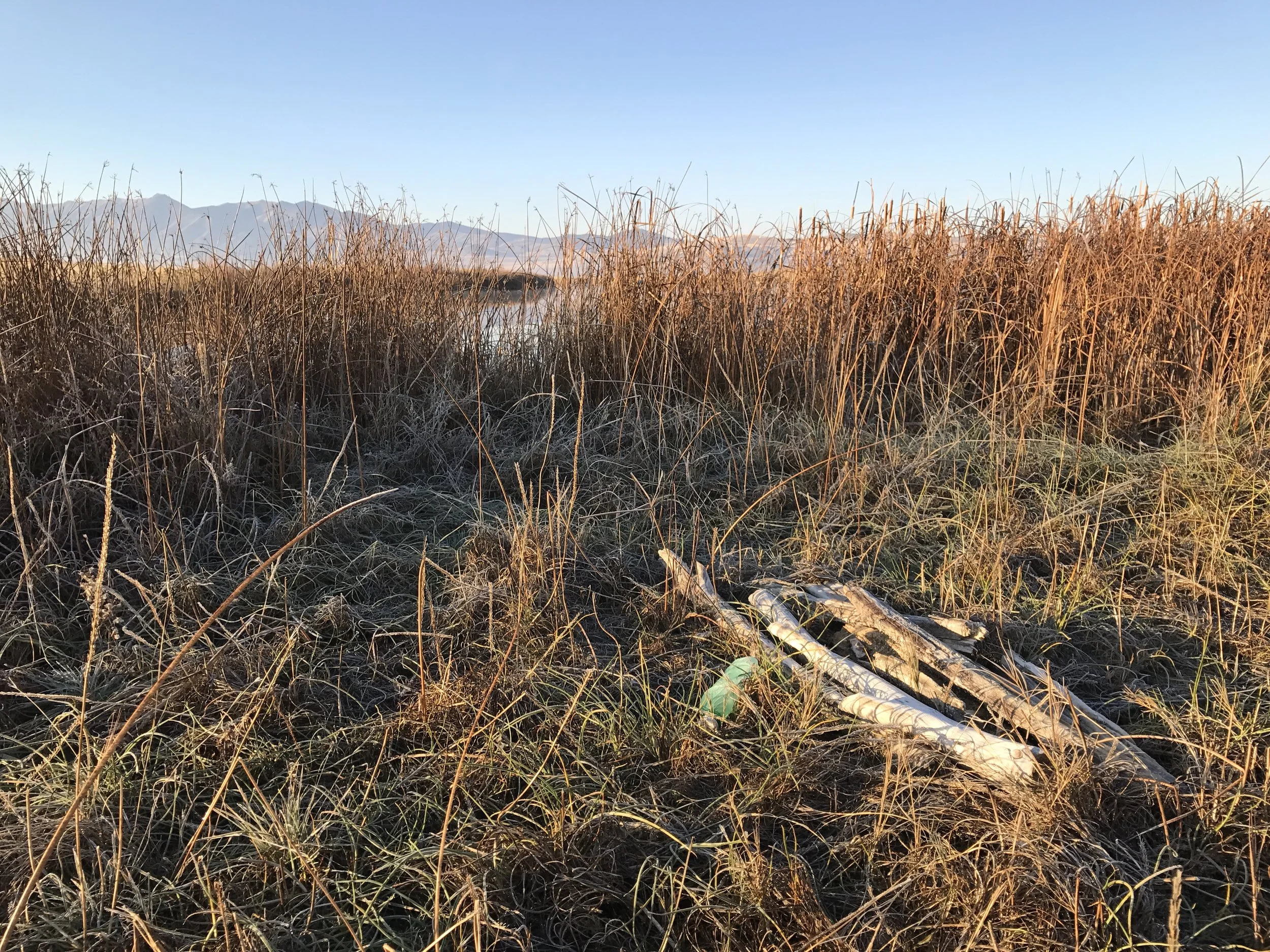
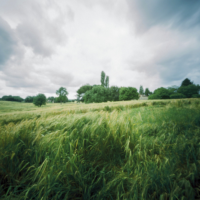
That afternoon Gina, Tommy and I went out and played tourist, and I took advantage of the nice light and made a few photographs.

Lake Tahoe at Commons Beach

Lake Tahoe at Commons Beach

Commons Beach, Lake Tahoe, California 2017

Commons Beach, Lake Tahoe, California 2017

As all the attendees were gathering together for dinner on Saturday evening, Gina, Tommy and I ran into Robert Dawson, one of my favorite photographers, and Ellen Manchester, Robert's wife, one of the photographers of the Rephotographic Survey. They invited us to sit with them, and I was a little giddy to sit with two photographers who have had such great influence on my work. We had a wonderful conversation, mostly about parenthood, and the joys of watching children grow and develop. Robert and Ellen have been working on a project involving children's education in Stockton, California, and another project on libraries around the U.S., and has expanded to libraries in Europe. They're both fantastic bodies of work.

Robert was the Honored Educator for the West Chapter, and he gave a wonderful presentation chronicling his many books he's published, as well as his latest work that he is doing, some of which is a collaboration with Ellen.

Robert Dawson

Robert Dawson

Sunday morning portfolio sharing

Sunday morning portfolio sharing

Being at the conference felt a lot rather like coming home, like I was with "my people." It felt so good to be amongst so many other passionate artists, and I'm looking forward to my next conference!

New Pieces

In my last blog post, I said I've been out photographing a lot this year. These are all the pieces I've been working on that's kept me busy enough to neglect the blog:

Two Hours at Newton Creek, May 24, 2017

Sunrise and Sunset on Buffalo River, June 17, 2017

March 2017 and September 2017 on Clay Slough

Three Hours on the Bear River, July 27, 2017

You can see more of these here

New Lumen #1

It's been pretty quiet here on the Departures blog a lot this year. It's not because I haven't been photographing. Quite the contrary. I've been out quite a lot. And I cranked out a lot of lumens this summer, and finally started scanning them in, and wanted to post this one quick, since I'm particularly pleased with it. I hope you will be too!

A Day on the Buffalo River

I've been waiting to post this until I had finished the other photographs from a recent family camping trip in Island Park, but my excitement to share this one has finally taken over!

I spent one of the days there making photographs from the same spot as the lighting and weather conditions changed throughout the day. The photograph below is the result:

This is just a digital rendering of what I have envisioned in my mind. The finished physical piece is intended to be an installation piece that will measure about 7.8 feet by about 4 feet, with each "bubble" being mounted directly to a wall. This is the direction I see these pieces going.

I need to spend a lot more time with the other photographs I made on our trip before I decide which ones to publish, but keep checking back for them!

David Shannon-Lier Interview

Last weekend I posted some photographs by David Shannon-Lier. I emailed him and asked some questions about the body of work, and he was kind enough to answer.

Andy Duncan: How long have you been working on this project, and do you think there will ever be an "end" to it, or point at which it will be considered finished?

David Shannon-Lier: I have been working on this project for a little over 5 years now, though the first year and a half to two years of that was spent figuring out how to make the pictures and refining my methodology. I hope to put a book of this work together and I am actually working on including long exposures of the movement of the sun. This is a little trickier as days tend to be a bit windier than nights. I am now building a folding wind break to bring with me on my trips after this last outing.

 AD: What was your inspiration for this work?

DS-L: The inspiration for the work came when I was driving from Massachusetts to Arizona for graduate school. I began to think about our old home and how as we drove west it was slowly setting below the horizon. It occurred to me that I rarely thing about the larger world in three dimensions. I wanted to make work that would point to that gap in our thinking. Now I see that gap as a metaphor for the gap in our conception of our own lives: we know we are small, ephemeral beings, but we can't shake the notion that the things we do every day carry some sort of weight.

 AD: How did it begin, and how has it evolved?

DS-L: The work began as mostly technical problems and solutions. How to plot the motion of heavenly bodies? How to do it accurately enough to where the pictures didn't fall apart? How to nail down the exposure, especially considering small apertures and reciprocity failure? These problems took the better part of a year an a half, most of the experiments taking place in my back yard. As I solved those problems, I began to travel in concentric circles around our home in Arizona, at which point I had to solve other problems to do with travel and how to do this out of a car and away from the support of a home base. Now all that is behind me, which makes the work easier, but in some ways less exciting in the execution. The concepts have developed a bit and I now see the work as about that particularly vexing mix we have as a species of being mortal, conscious and aware that we are both.

 AD: Do you have any thoughts or ideas of what comes next for your photography?

DS-L: I am always taking pictures of things that fascinate me. I am interested in the landscape and the sublime, particularly that aspect of the sublime that is closest to fear or dread. It seems to me in these moments we can begin to get at that human knot I mentioned above.

 AD: Who is a favorite photographer of yours?

DS-L: There are a lot. I find the best persona to embody as a visual artist is a compulsive thief. It does no good to steal from one artist or movement, or even one medium. But if you can constantly be taking in new information, and stealing a bit from here, a bit from there, from other artists as well as science, philosophy, theology, culture the work will end up being rather more interesting. This is all to say that sometimes (as is the case with compulsive thieves) I am unaware that I am borrowing from some area until long after and I could spend entirely too long listing all of them. All that being said I will mention Bill Burke and Mark Klett, who I worked closely with and who have influenced me by osmosis. Also, someone who is working now and really gets at the ideas of the landscape and the sublime is Michael Lundgren.

 AD: Because I'm a bit of a tech junkie, what programs or software do you use to project or predict the positioning of the sun and the moon?

DS-L: The solution to that technical problem was to use very accurate data and a very accurate tool for measuring the data. I started getting my data from the U.S. Naval Observatory, but I now use an app called stellarium. It has the same data, but is a little easier to access on the road. From that I can get the precise location for any heavenly body at present or in the future. I use a surveyor's tool called a transit, or a theodolite to plot the points that I get from the data, and then place my camera in the spot where the transit made its measurements. It's a bit more complicated than that and a lot more tedious, but that's the gist of it.

Man, I loved the part about stealing from everywhere!  I've heard the quote that's often attributed to Pablo Picasso: "good artists borrow, great artists steal." But for all the times I've heard it, I never really thought to apply the stealing to all facets of life, not just to steal from other artists.

Thanks for your time David! I can't wait to see more of your work!

David Shannon-Lier

Clear back in October, Lenscratch had an article in their Art + Science series on the body of work by David Shannon-Lier titled Of Heaven and Earth. The first image in the article, Chalk Moonrise, Muley Point, Utah, pulled me in, since I love long exposures of the moon and sun, but also, there was more to the image than just the long white arc of the moon as it traveled across the sky: on the rocks in the foreground is a light line that matches the radius of the moon's path. 

Chalk Moonrise, Muley Point, Utah

Chalk Moonrise, Muley Point, Utah

Not only are these absolutely gorgeous photographs, but the concept behind them is so fun and interesting! 

In a LensCulture article, Lier says this about his work:

To produce each photograph, I leave open the shutter for a very long exposure. The result is an image of the moon or sun playing off of an altered landscape. In this way, the heavenly meets with the human, the immense with the intimate and one of the most constant forces in our world—the movement of the solar bodies—interacts with a line of rocks or grass: a mark that is small and completely fleeting in meaning and form.
Badlands Moonset, Badlands National Park, South Dakota

Badlands Moonset, Badlands National Park, South Dakota

To see more of Lier's work, which I highly recommend, you can visit his website. Also, he's been featured on LensCulture, Fraction Magazine, and Hoctok.


Litter

Just about everywhere I go to photograph, hike, fish, or camp, there's always some sort of litter, and almost always, there's a beer can or bottle to be found. I try to practice what I learned as a Scout to "pack it in, pack it out," and "leave a place better than I found it." Lately, I've been using the litter I see as visual exercises to make found still life photographs before I pick it up. I don't know if anything major will come of all these photographs but I feel they're still important in my image making.

Mountain Dew

Mountain Dew

Michelob Ultra

Michelob Ultra

Corona Extra

Corona Extra

Coors

Coors

Julie Anand & Damon Sauer

A little while ago LensCulture announced their 2017 Exposure Award winners. Among the superb photographers represented were a pair who, for the last 12 years, have been working collaboratively. Ground Truth: Corona Landmarks by Julie Anand and Damon Sauer immediately resonated deeply in me, and the images and concepts behind this body of work have been bouncing around my mind ever since.

I admit to feeling a small amount of jealousy when I first saw the photographs. It was another of those "I wish I'd thought of that!" moments. But I'm glad  those moments occur, because they are, in the end, motivating. They make me think about my own work in new ways; how to look at the world in new ways.

I emailed the artists with several questions about the Ground Truth work, and I was pleased to receive a quick response from Julie. Here is our exchange:

Andy Duncan: Can you explain a little about the origins and inspiration for this project and how it came to be?

Julie Anand: Damon read an article conjecturing about strange marks in the Gobi desert hypothesized to be used for satellites and it linked to a single site in the Arizona desert. We made a field trip and eventually found more and eventually Damon mapped the entire system using Google Earth. Meanwhile we did research and found that in 2004 a pilot had discovered them from above and linked them to the Corona project. So we started exploring them photographically. Eventually we started using a 16ft boom. At first they were pretty straight documents and we went around photographing markers that way. Then we got a grant for a new camera and had to redo all our work, so we rethought it and turned them into vertical landscapes. We did that for a while. Finally, we added the layer of looking at what satellites are present now. It took a couple of years for us to develop this methodology. It wasn’t our first draft by any means.

AD: How long have you been working on the project, and how much longer do you think it'll take before you consider it to be finished?

JA: We’ve been working on it for about three years, and as I mentioned above, we went through several different versions of how to explore these markers. Our website isn’t up to date (we have a fresh batch of images in progress right now), and we’re still negotiating what it will mean to be finished.

AD: How do the paths of the satellites influence the composition of the photograph? And visa versa? Or do they?

JA: The satellite paths are a chance operation with respect to the photographs. We have no idea what they will look like when we make our images.

AD: Do you make the photograph and then look up and superimpose the satellite paths, or look at the paths first in your tracking software and then make a photograph with the satellites' paths in mind for the composition?

JA: The photograph comes first and that gives us the data for plugging into the software to determine the satellite paths.

AD: How many photographs do you make at each marker?

JA: We usually walk around and decide what would make the most interesting vantage and make a couple of different versions. Each final image we make is stitched from about 5 images. It’s a fairly big set up with two tripods, sandbags, 16ft boom, tethered laptop etc…precisely measured…so we’re not very “casual” about moving around, but we know that getting to the sites takes a lot of resources and energy so we try to give ourselves options in the field.

AD: How many markers have you photographed so far? Are they all still extant? Looking at the map on the website, I see some blue marks and some green marks. Can you explain the significance of the two? Am I correct in assuming that the green marks indicate the marker at that location is missing for whatever reason?

JA: We have a fresh batch we’re working on right now. When we are through with those, we should be at around 40 completed images. The map is an important part of the project that represents significant research. We plan to show the map in the exhibitions with our images. The map has several layers of things going on. Green marks are ones in which there is no photographic record of any kind available for the site. Otherwise, light colored crosses reveal our images, or dark blue crosses have embedded color Google Earth historic images or black and white aerial images that Damon researched if it wasn’t on Google Earth at all. But just because we’ve researched a historic aerial or historic Google Earth image doesn’t mean the marker is there today. I created a spreadsheet of all the sites and about 100 markers have been removed.

AD: Are there any markers that you've decided to not photograph because of lack of visual interest? Or has there been an additional purpose of cataloging each marker?

JA: We haven’t edited out sites at this point because we’re never quite sure what they will look like once the satellite map is created. Since that’s a chance operation, sometimes even very plain ground views produce stunning line drawings. We’re still deciding about what we think “complete” should mean for this project. But intuitively we feel we’re not finished, so we keep working. We have other things we want to try as a parallel practice to the photographic typology.

AD: Are these markers still used by the Air Force and CIA? If there are some missing, I can't think that they are still used, otherwise they would be better maintained. Also, if some are missing, and this grid is no longer used for satellite calibration, how are satellites calibrated today? Is there a new grid of markers somewhere to serve this purpose? Or is that information possibly classified?

JA: The project was decommissioned in 1972 and the markers have been decaying in the desert ever since. The Corona project was declassified in the 1990’s. We have an appointment to talk with a satellite scientist to find out more about how these were used, to help us interpret patterns in our sky maps we are creating, and to learn more about contemporary calibration systems.

AD: How did the government acquire the land, with the Corona Project being a secret joint program? Was the land bought from the then owners of that land?

JA: The Army Map Service leased the land in 100 foot parcels from land owners...There is a lot of speculative stuff online and we need an actual historian to do some work on this field. We are looking for a historian collaborator.

I'd like to thank Julie here on the blog for taking the time to answer my questions. After reading her answers, I was even more excited about her and Damon's project! I can't wait to see how it progresses! Head on over to their web site at 2cirlcles.org to see the whole collections of photographs. Read their statement. Check out the map, and don't miss the Process video! I love seeing the "behind the scenes" of how artists make their work, and this video really shows how much work goes into making just a single photograph of these landmarks.

I found a Youtube video of a presentation Julie gave in 2015 at WSU. It's worth watching if you've got a little extra time to spare. You can also check out an article about the Julie and Damon's work on Wired Magazine: These Concrete Relics in Arizona Helped Satellites Spy on the Soviets—Wired Magazine


Calibration Mark X47 with Satellites

Calibration Mark AC47 with Satellites

Calibration Mark AE48 with Satellites

Calibration Mark AC48 with Satellites

Bear River Migratory Bird Refuge and Grace

It's been a while since I posted here; I've tried to post at least once a month beginning in 2016, but I let April slip by. That doesn't mean I haven't gone out photographing since my last post. I've been to the Bird Refuge west of Brigham City a few times, to Grace, Idaho twice, and around Cache Valley quite a bit. Here are some of my favorites:

Benson Marina, Utah 2017

I've been trying to get out along the Bear River and some of its tributaries as much as possible. The rivers have all been running really high in the Bear River watershed from the rain that melted the snow off so quickly here in the valley, as well as the natural spring run-off. And this last week has brought warmer than usual weather which has really made the rivers run high.

Just after the rain that melted all the snow, Gina and I took a drive out to the Bear River Migratory Bird Refuge. We were really out on a date on the 2nd anniversary of our first date, and we figured we'd go take a look. We ended up not being able to go very far, since the high water had flooded a lot of the roads there, and the main gate to the refuge was closed. A few weeks later, I headed out to see what things were like with so much water flowing through.

Head Gate, Bear River Migratory Bird Refuge, Utah 2017

All through the refuge were piles of logs and other debris that had been pulled out of the river and canals to prevent damage to the head gates and prevent further flooding.

Debris Pile, Bear River Migratory Bird Refuge, Utah 2017

Drainage, Bear River Migratory Bird Refuge, Utah 2017

Seeing all the water flowing through the lower reaches of the Bear River made me want to get further upstream to photograph what was happening there, so I headed up to Grace as soon as I could fit it in to my schedule. On April 1 I got up early enough to be in Grace before sunrise. The dam just north of town had more water flowing over it than I'd ever seen.

Grace Dam, Grace, Idaho 2017

Last Chance Canal and Bench A Canal, Grace, Idaho 2017

Lately I've been playing around with in-camera multiple exposures, and walking past, or around an object in the landscape. This one is 10 exposures, walking 5 paces between each exposure.

Clay Slough, Utah 2017

A few weeks ago I went back up to Grace. I searched out the location of the Cove Dam on the Bear River that was removed in 2006. I feel like there's a budding project on the Bear River watershed.

Former Cove Dam Site on the Bear River, Utah 2017

Former Cove Dam Site on the Bear River, Utah 2017

Power Lines and Power Poles, Grace, Utah 2017

My work with the collages continues on. Earlier this year, I made a collage of the tree in the winter (Thirty Five Minutes in Amalga) with what I've been calling "bubbles" in my head—photographs made long after the initial establishment of a scene. When I first made the photograph, I felt pretty excited about it, but after spending some time with the image, and a subsequent critique, the piece isn't as successful as I first thought. Part of it has to do with the time frame in which each frame and bubble in the photograph was made. Only thirty five minutes had elapsed, and in that time there was no change in the lighting conditions at all, despite some movement in the clouds that made me think the sun might break through.

Despite that unsuccessful attempt, the idea of these bubbles of time kept swimming in my head. Then I ended up out on the Cutler Marsh at Benson Marina in front of a large tree. There was a slight breeze, with an occasional strongish gust that really stirred the branches and disturbed the surface of the water behind the tree. Clouds moved in the sky, lighting the tree up for a few seconds before covering the sun again for another short period of time. That's when I started making my bubbles after I'd made an initial photograph. The resulting photograph is below. After I got home, I made one print to provide a base, and context to the bubbles, which were made over the course of an hour. I then printed each bubble and cut them out, then placed them on the print with a pin. They each stand off the print about an inch. I'm really excited about this new direction my work has taken. There are so many possibilities and directions I can go from here...

One Hour as the Sun Sets at Benson Marina

"Awaiting the proper moment"

The words from this post's title come from Alfred Stieglitz in describing how he made Winter, Fifth Avenue. I read them this morning in On Photography by Susan Sontag. In the chapter "The Heroism of Vision," Sontag explains that "...Stieglitz proudly reports that he had stood three hours during a blizzard on February 22, 1893, 'awaiting the proper moment' to take his celebrated picture..." The next sentence carries an important lesson: "The proper moment is when one can see things (especially what everyone has already seen) in a fresh way."

I've spent the day thinking on those words. Finding the "proper moment" is something every photographer hopes to do, as is seeing things in a "fresh way." It's something I, in full honesty, struggle with. But, as I've been thinking about how to see things in a fresh way, I realized that that's why I keep returning to Benson, and Amalga, and Newton, and all the other places throughout Cache Valley.

I also wondered how true, or how literal Stieglitz's story is. Did he really stand in a blizzard for three hours? So, I did a quick Google search, and found this on The Art Story:

Winter, Fifth Avenue shows the busy New York street in the midst of a snowstorm. Stieglitz stalked Fifth Avenue for three frigid hours waiting for the perfect moment. He had to wait for the ideal composition - unlike a painter, who could manufacture it. Trails in the snow lead the eye up this vertical composition to its focal point - a dark horse and carriage that is swallowed by the snowy atmosphere. The snow blurs the details of the urban surroundings, lending the photo an Impressionistic appearance. This depiction of man - crudely mechanized - and pitted against the violence of the natural world, shows Stieglitz’s inheritance from nineteenth century Romanticism.

OK. So it's not a direct quote from Stieglitz, but it is another voice that corroborates his account. As I thought about Stieglitz standing in a blizzard for three hours, waiting for that "proper moment," I wondered if he got bored at all. Did he stray at all from from the spot where he made this photograph? Like Weston's peppers, did he make more than just the one exposure? Or did he only make the one after he felt like all the various elements had finally come together? How heavily trafficked was that street? Did he really have to wait three hours for that photograph?

Then I got to thinking: If I were to go stand in one spot for up to three hours or more, how would I handle it? Would I die of boredom first? I think the answer to that one is maybe, though my recent collage work has had me staying at the same location for longish periods of time. But if I weren't already used to that, what would I do? Would I spend time on my phone looking at Instagram or Facebook, thereby missing the "proper moment?"


Latest Work

The opening weeks of 2017 have been pretty wild, at least where the weather is concerned. We were hit with a few storms back to back, netting us almost two feet of snow. Then the snow turned to rain for a week last week and almost melted it all. I've been able to get out a few times and photograph, both before and after the rain. With so much snow melting so quickly, there's been flooding in town and the Bear River rose about three feet (disclosure: that measurement is just an eyeball measurement, not anything official from USGS flow data).

Hyrum Gibbons Mount Logan Park, Logan, Utah 2017

Hyrum Gibbons Mount Logan Park, Logan, Utah 2017

Snow Covered Field, Amalga, Utah 2017

Thirty Five Minutes in Amalga

South Logan Benson Canal, Utah 2017

25 Paces North and South Walked 10 Times

Private Property, Amalga, Utah 2017

Submerged Sprinkler, Utah 2017

First Works of 2017

We're almost three weeks into 2017. This new year holds a lot of potential for me as an artist. Two of my photographs have already been in two separate exhibitions, and there are still eleven months in the year to continue applying to shows and creating new work. I'm pretty excited about the direction my work took in the middle of last year, and I'm excited about the direction it has continued.

On that note, here are a few of my first pieces of 2017:

Ten Minutes at Lower Bear River Recreation Area

Ten Moments in Benson

Thirty One Minutes in Amalga

Forty Two Moments in Bear River Migratory Bird Refuge

2016, The Year in Review

Two Thousand Sixteen has been a pretty significant year for me in many ways, the greatest of which was the birth of our baby boy in November. 

Thomas Wade Duncan

Thomas Wade Duncan

Like I mentioned in my last post, life has been a little upside down. With caring for a newborn baby, it's been difficult (read: almost impossible) to focus on art. I have, at times been able to work on post-processing and editing scans of negatives I made throughout the year after getting back into film photography. Ive also tried to keep my mind occupied with art and photography by reading my various photo books (I'm currently half-way through Vew Finder, a book about Mark Klett and his team's efforts in the Third View Rephotographic Project), and Instagram remains a good source of inspiration to me. The hardest thing to do in my creative pursuits has been getting out to create new work. I haven't minded for the most part, because A, I have a new baby to spend time with, and B, the aforementioned activities have done well in satiating my creative drive.

Another way this year has been significant, is I've been much more focused on creating art than I have for several years. As a result, I've seen a large improvement in my confidence as an artist. That confidence is a product of the time I've invested in creativity this year, as well as having a few very valuable critiques of the direction my work has taken this year. I've submitted to four shows this year, and been rejected by all of them, which was hard to take, but I've learned lessons there as well. 

As a sort of retrospective, I thought I'd share my top 10 favorite and/or what I feel are the most significant in my creative pursuits photographs from 2016: 

10. Cutler Marsh Near Benson Marina, Cache Valley, Utah, 2016

Cutler Marsh Near Benson Marina, Cache Valley, Utah, 2016

The sun had almost set below the mountains to the west of Cache Valley when I slammed on my brakes after seeing these three trees with a post laid in their branches. I rushed out of the car, set up my tripod in the middle of the road, composed the shot and made the exposure before the truck coming my direction got any closer. At the time, I was so hurried to get off the road that I didn't notice the beaver-chewed trunks of the trees. I don't know when that post was placed in the trees, or by whom or why, but I was intrigued and attracted to the geometric shape juxtaposed against the organized chaos of the branches of the trees and their trunks. It was still there when I drove past a few weeks later, but was gone after another few weeks.

9. Bear River, East Pass, Bear River Migratory Bird Refuge, Utah 2016

Bear River, East Pass, Bear River Migratory Bird Refuge, Utah, 2016

The Bear River Migratory Bird Refuge is home to some very interesting natural and man-made features. Dikes and other structures provide water depths that the various species of birds require. There are mudflats, wetlands, marshes, open water, and canals. This photograph contains many of those features. I wanted to capture the expanse of the two large open bodies of water separated by another body of water—this one a flowing canal. The bridge was another feature that caught my eye. In fact, it was the first thing that I wanted to capture, but looking through my viewfinder, I knew that the scene I needed to record was much wider than just one frame could contain, so I made three photographs and then stitched them together in Lightroom.

8. Bear River, Benson, Utah 2016

Bear River, Benson, Utah, 2016

I'd driven past this area several times and never really given much pause until this day. I'd just gotten my medium format rangefinder, the Fuji GSW690iii, also known as the "Texas Leica," and I decided to come here to make my first exposures on film in almost eight years. The water in these lower parts of the Bear River is dirty and murky. Longer exposures like this one obscure just how disgusting the water through here can look, a dichotomy that I'm not sure how to reconcile. Maybe it's not so much not knowing how as it is not wanting to. This would be an entirely different photograph had the exposure been shorter. 

7. Wheat Field During Sunset #1

Wheat Field During Sunset #1

One late afternoon in June, I went back out to the Lower Bear River Recreation Area in Benson to photograph, but the wind was blowing so hard out there that it was causing all of my photographs to blur, which made me think to use intentional camera movement to breathe abstract images. This was the first of such images that I've been making this year. I'm not sure if anything big will ever come of them, but it's still a fun visual exercise. Some of these that I've done have the feel of the landscape rushing by as you drive down a freeway, or turn on the spot, changing your point of view. Others have an other worldly feel, as if features in the landscape are phasing in and out of parallel universes. Maybe there really is more to explore with these.

6. Snoqualmie Falls, Snoqualmie, Washington 2016

Snoqualmie Falls, Snoqualmie, Washington 2016

Gina and I went to Seattle for our first anniversary in July, and we went to Snoqualmie on one of the days we were there. We'd heard about Snoqualmie Falls, and seen the feature on our Instagram accounts, so we knew we had to add it to our itinerary, and we're glad we did. For this photograph I wanted to break away from my usual treatment of water, which is to get a longish exposure in order to get that nice cotton candy effect. But the falling water and billowing mist made so many nice patterns and shapes that I wanted to capture. I also wanted to include as much of the surrounding landscape as my lens would allow to provide some greater geological context to the waterfall.  

5. Beach Access, Alki Beach, Washington 2016

Beach Access, Alki Beach, Washington 2016

Alki Beach and Alki Point west of Seattle was another place on our itinerary on our anniversary trip. This staircase seemed sort of a monument, or one of a series of monuments, and sought a composition that would portray it as such, and knew that black and white would further emphasize that feeling. 

4. Stop Sign, Telephone Pole, Benson, Utah 2016

Stop Sign, Telephone Pole, Benson, Utah 2016

On my way back home after photographing at the Benson Marina, I approached this intersection, and, like the first photograph, was drawn to the straight telephone pole standing in the middle of the group of trees. It was a foggy and cold day, and the light all morning was mesmerizing. I parked the car a little ways down the road from the intersection, thinking of just photographing the trees and the pole, but all the elements of the stop sign, the trees, and the gas line post all came together perfectly. I set the tripod and the camera down and composed the photograph and made an exposure. I reviewed the photograph on the LCD screen, and then heard the approaching truck and knew that that was the one missing element in making this photograph even better. I waited, and as the truck entered the frame I tripped the shutter and came away with this resulting image.

3. One Month at Upper Bear River Recreation Area

One Month at Upper Bear River Recreation Area

At the beginning of the year, when I decided to get serious about making art again, I brainstormed quite often for ideas on a new project to keep me engaged. While I deliberated on something that excited me, I knew I had to just keep making images and keep my creative mind active, so I kept returning to Benson. Even if no project came to mind to specifically work on, maybe something would emerge from all the images I ended up making. I kept feeling like I needed to do something on the Bear River, but I didn't know what. The water from the Bear River and the Bear River Watershed is used extensively for many reasons: irrigation and agriculture being perhaps the biggest, as well as hydroelectricity. I thought a project could deal with one of those issues. But then, I remembered the work of James Balog, and his photographs of redwood trees, and I knew I had a direction in which to work. This piece isn't the first one I made working in this collage panorama format, but it is the one that kept me most excited. I returned to this place several times within a month and added the new photographs to the panorama. I've actually made many more trips to this very place, since the initial idea was to include images from all times of year in the single piece, but the more images I tried to add, the more chaotic and unorganized and messy it got. I'm still interested in having collages with all four seasons, but I think I need to start out with a simpler composition.

2. Twenty Minutes During Sunrise

Twenty Minutes During Sunrise

While out at the Benson Marina, I saw this tree, and made a traditional photograph of it and almost walked away, but decided to make a collage of it before I left. I'm glad I did. I began making exposures about eight minutes before the sun rose above the mountains, and ended making them about 12 minutes after. With this particular piece, I discovered that I like these closer images of a single subject, rather than including a wider scene, such as the previous image. I was quite pleased at the result. I like that there is different quality of light in just about every frame within this collage.

1. Eight Minutes at 0 Line Canal

Eight Minutes at 0 Line Canal

One thing that was suggested to me about this project was to have to have a hybrid of the seamless panoramic photograph and the collages I'd been doing. That is to say, have a seamless panoramic photograph composed of images made at different times and/or on different days. This particular one was one of the first collages I made after receiving that feedback. True, it isn't a completely faithful application of that feedback—I'm still trying, after three weeks, to edit a photograph that is faithful to it. It is still one that I'm pretty excited about, and just one more way to explore that idea of the passage of time.

Around Cache Valley

One month and two days ago, Gina and I welcomed our first child into the world, and ever since, life has been pretty upside down. I was finally able to get out and photograph for the first time this morning.

Cottonwoods by State Road 142, Amalga, Utah 2016

Dead Deer at Bear River Bottoms WMA, Utah, 2016

Phragmites

Flooded and Frozen Field, Amalga, Utah 2016

Eighteen Minutes in Amalga

New Collages

The project with the collages continues. Here are some of my latest efforts:

Twenty Minutes During Sunrise

Twenty Minutes at Whistler Canal

Eight Minutes at "0" Line Canal

Questions

As a photographer, I've always tried to show how Man interacts with the Earth. Well, not always. When I first began my formal training, it was my goal to show an untouched, unaltered landscape. I don't remember exactly when I realized that such a goal was almost impossible. Especially if you include the whole of Man's history on Earth. I think the realization occurred either in between my freshman and sophomore years in college, or very early in my sophomore year. I remember feeling a bit deflated. Not necessarily because I lamented the loss of untouched pristine nature, though that lamentation certainly did come. But mostly, because at that time, my goal (as is it still remains) was to capture Beauty. But my definition of Beauty in Nature excluded those places where Man had been. I've since realized that it's a bit like Schrödinger's Cat. Even if Man hadn't been in a spot I desired to photograph, or been in the scene I was composing, me being there had introduced Man in the land.

While out photographing the landscape, documenting and observing the changes that have occurred either via natural processes or Man's construction of all the various features to further civilization, several questions come to mind. Some are very easily or quickly answered, and some take some research. Some are more philosophical in nature.

Here is my list of many of the questions that I think about:

  • Why was this feature created?
  • When?
  • Who made the feature?
  • How was it done?
  • Is it necessary?
    • Was it necessary at the time it was created?
    • Is it necessary now?
      • If so, is there a way to improve it?
      • If not, how can it be removed?
      • If the thing is necessary, is this the best place for it?
    • What can we learn from the creation of the feature?
    • Can the feature be improved to make it more effective or efficient?

Whether a landscape photographer, street photographer, portrait photographer, what questions do you think of while you've got your camera in hand?

Nils Karlson

A couple months ago, the Film Shooters Collective Instagram feed featured Nils Karlson. It was "love at first sight." I tapped through to his feed, and followed him. Ever since, I've loved seeing his images come up while scrolling through my Instagram.

Karlson lives in Germany, and uses a mix of medium format cameras, and pinhole cameras, and shoots on a variety of color films.

I was immediately attracted to Karlson's aesthetic. The high-key tones, the soft color, selective focus in some images and the tell-tale softness and vignetting of a pinhole photograph in others, give his images an airy, dreamy quality. I feel as though I'm dreaming I'm on the beach, feeling the humid, salty air blow across my skin. In others, it's as though I've been shrunk down to the size of an insect.

He was recently featured and interviewed at the Pinholista, and you can find it here, and you can also see more of his work on his flickr page.