Spawn Creek

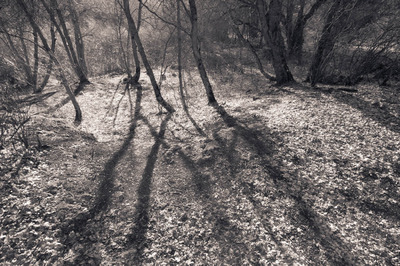
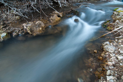
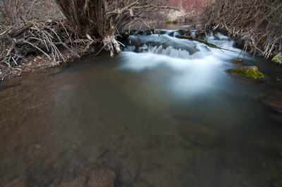
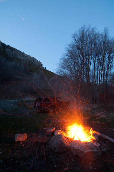
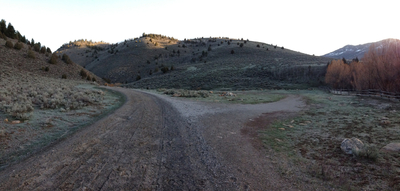
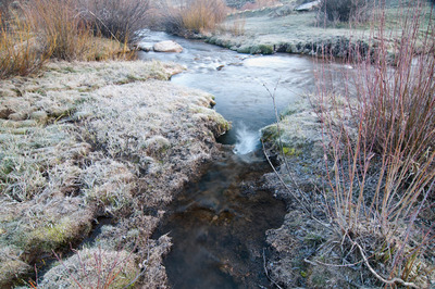
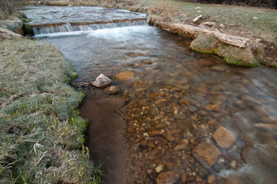
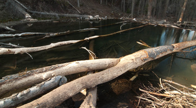
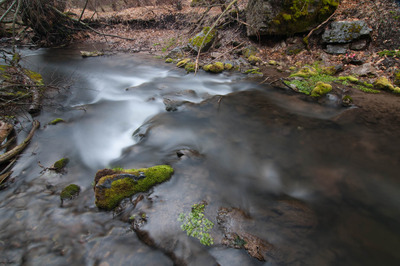
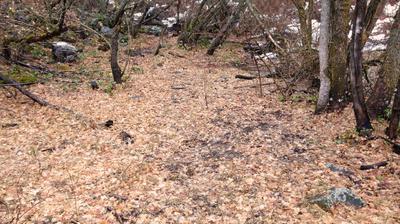
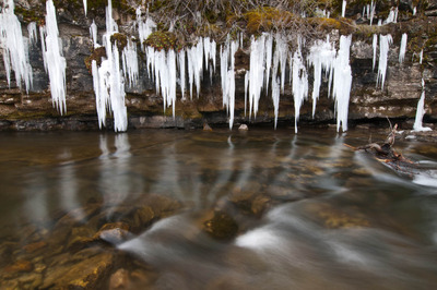
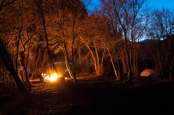
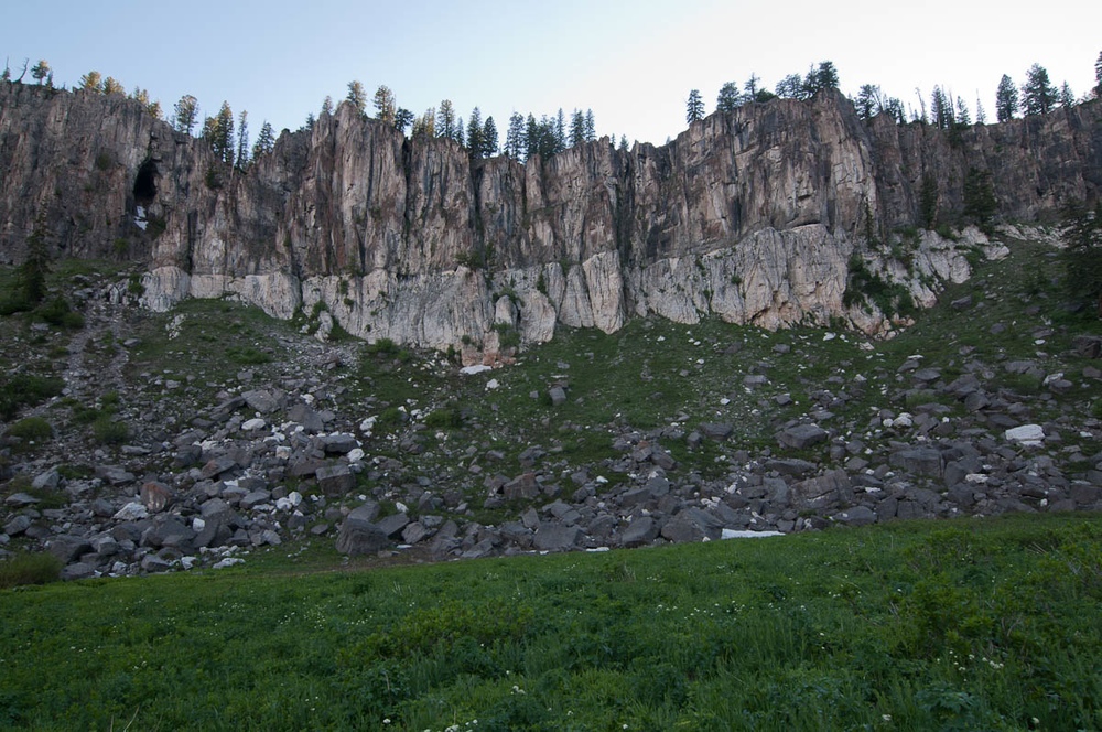
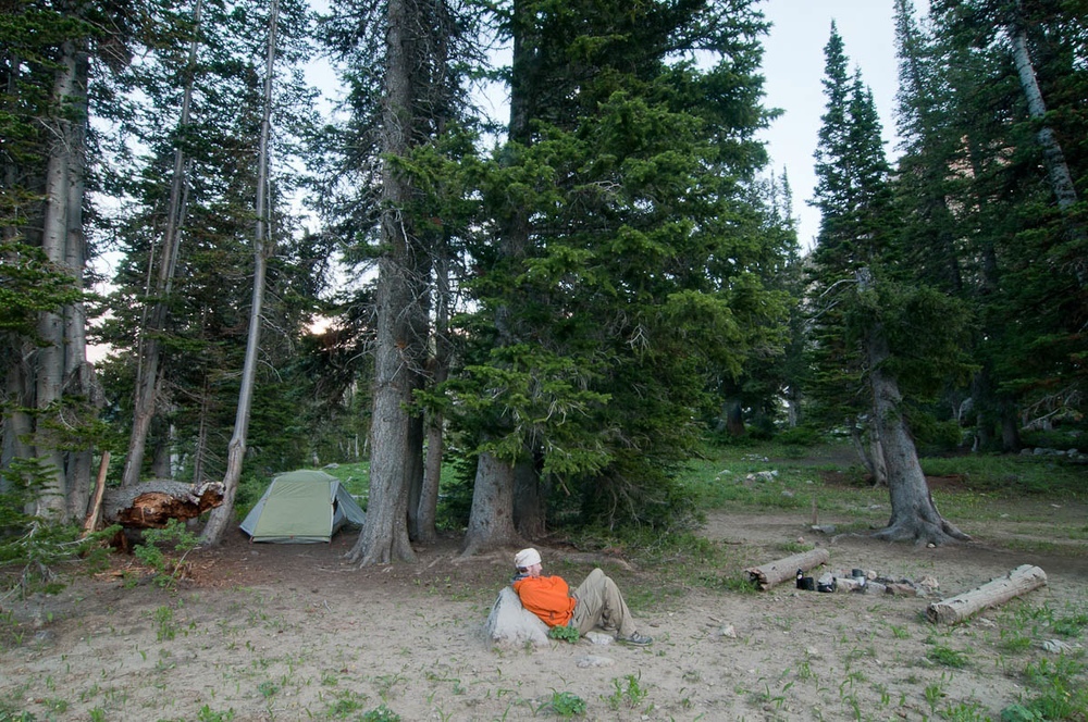
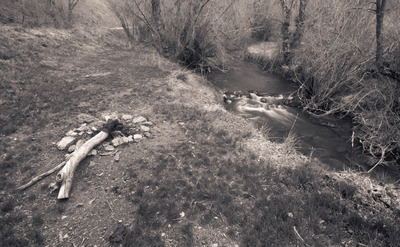
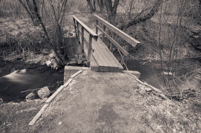
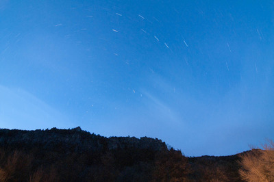
I think last night was the last night I'll spend in Right Hand Fork Canyon for a little while. I need to spend some time away from it in a new place. I feel my images there are becoming homogenous. Then again, photographing there under the morning light would help bring some variety to the work. Anyway, here are some images I made last night:

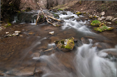
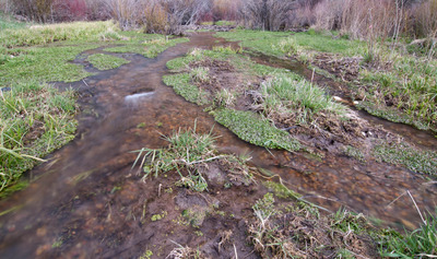
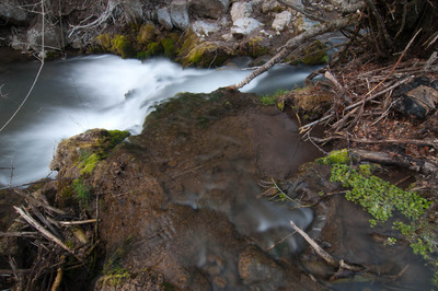
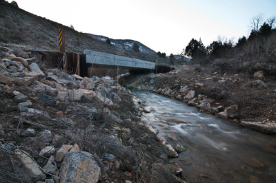
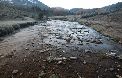
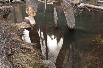
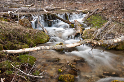
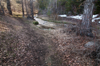
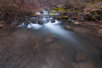
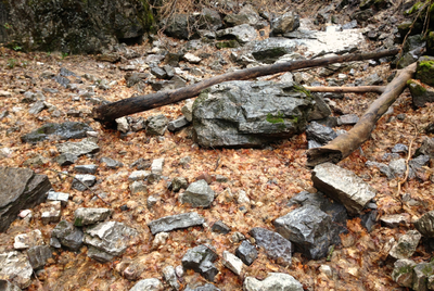
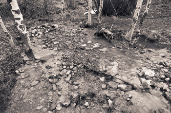
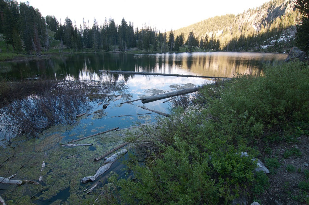
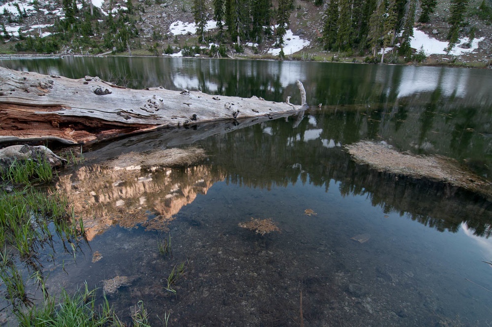
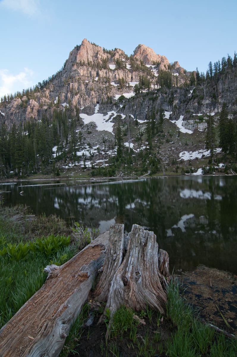
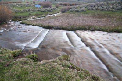
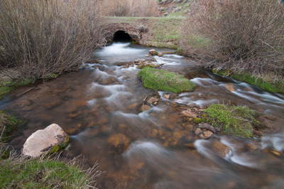
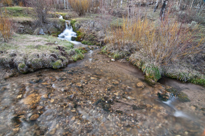
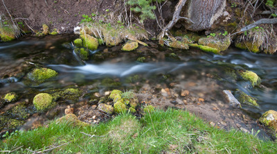
I had decided on hiking up Spawn Creek today, and was on the trail bright and early. Well, it was actually kind of dark, but plenty early. Spawn Creek is a small creek in the Temple Fork watershed. It drains into Temple Fork near the trail head to the Temple Fork Sawmill. And like Temple Fork, there are plenty of beaver ponds along the creek, with schools of Bonneville Cutthroat Trout that spook easily. I'll have to take my rod up there one of these days. It'll be a perfect test of how stealthy a fly fisher I am.

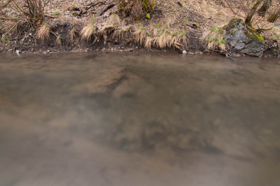
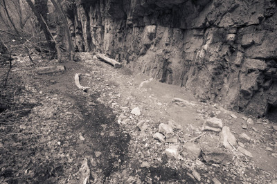
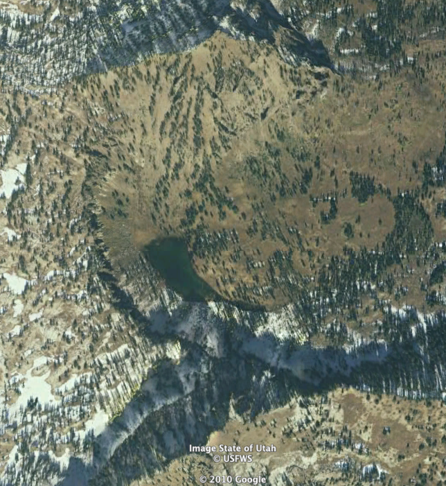
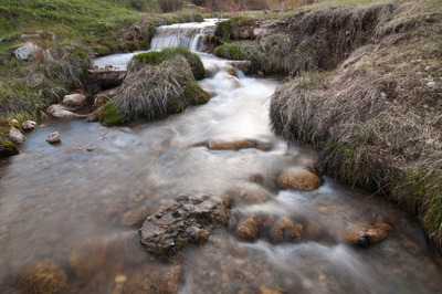
Temple Fork and Spawn Creek, along with the upper Logan River in the Franklin Basin, are spawning habitat for the Bonneville Cutthroat Trout. An old road used to parallel Temple Fork, and overgrazing, and general misuse of the land lead to poor water quality in the Temple Fork watershed. In 1999, the old road was removed, along with stream-side campsites, and the area was rehabilitated. Better grazing management practices were adopted. All this has served to greatly improve the health of Temple Fork and Spawn Creek, thus improving also, the health of the Logan River.

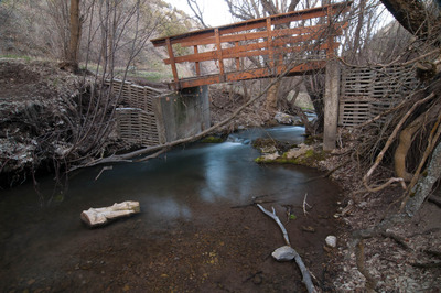
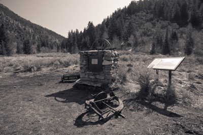
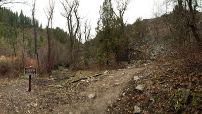
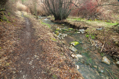
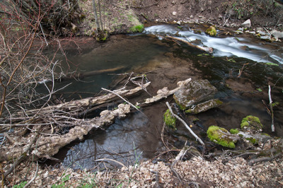
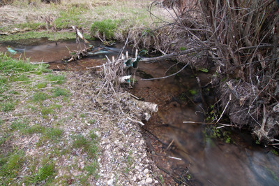
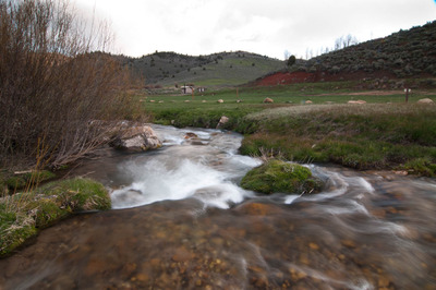
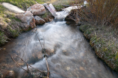
At the confluence of the Temple Fork and the Logan, there are two rectangular frames made of 4" diameter steel pipe, and a mesh fence. Since there are efforts to rehabilitate the native cutthroat trout in Right Hand Fork and Temple Fork, I assume, since there are no natural barriers, that these act as the barrier to the brown trout in the Logan River, preventing them from creeping up Temple Fork. I need to talk to the rangers at the Ranger Station and get some better info than just assumptions.

Three of the steel rectangles are placed above the confluence of Spawn Creek and Temple Fork. I assume these are there to direct the cutthroats up Spawn Creek, though I don't know why whatever conservation group would want to block Temple Fork. Again, I need to do some investigating. 

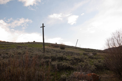
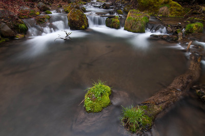
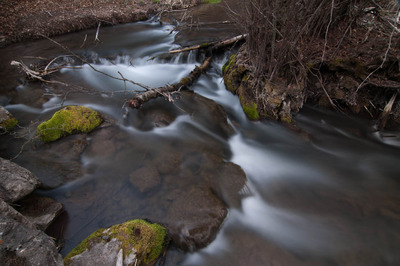
I've always loved the scenery along the highway through Logan Canyon, but there is so much more to see in the Bear River Range and in order to see it, you have to get out of your car and walk, and only those willing to do so are blessed with the rewards of even more beautiful scenery, sounds and smells. I just can't wait for the trees and shrubs to regrow their leaves and the flowers to bloom. Rest assured, I'll be there with my camera when they do.

Temple Fork

Wanting to see a different part of the Bear River Range, I decided on hiking the trail up Temple Fork this weekend. But not before spending the night in Right Hand Fork Canyon again. I've mentioned how convenient Right Hand Fork is for just pulling off the road and pitching a tent. Skipping the tent and just sleeping in the back of the 4Runner makes it even more convenient. I know, I said I wasn't going to cheat and do that, but it allows me to hit the trail much earlier than if I'd pitched a tent, and I wanted to be on the trail as early as possible. Partly for the nice morning light for photographing, and partly because when the weather gets warm, as was forecasted for today, I like to hike in the cool morning air.

I've decided to try and incorporate Right Hand Fork to be it's own photographic project, as I mentioned I thought of doing last week.

This morning I was on the trail by about 6:30. There is a dirt road that connects Temple Fork to Right Hand Fork, Left Hand Fork, Blacksmith Fork, and if you take the right roads, you can end up at Bear Lake. Right now, those roads are gated off, and any hikers wanting to hike the trails up Temple Fork, have to start at the gate, adding about a mile to the overall trip, not that that's a bad thing.

I made it almost all the way across this bridge and then thought it just needed to be photographed.

A little further up, I turned around and saw this:

Then walked another hundred feet or so and photographed this:

At the actual trailhead to the Temple Fork Sawmill Site (more on that later), there is a beaver dam. I made this photograph:

And then this:

And this:

I continued following the stream off-trail, stopping and making photographs as I saw them, which was pretty often. Here's just one of them:

I'm not 100% satisfied with most of the others. I'll need to spend some time with them, and I'll post them later if I deem them worthy of a blog post.

After I'd made that photograph, I finally got back on the trail, and set out for the Sawmill.

The trail parallels the stream the whole way, never getting more than about 100 feet away from the water, so the hiker is constantly accompanied by the sound of the water dribbling over a shallow bed of pebbles, or crashing over feet-high drops in elevation. The chirping of birds waking up also provide more melodies and harmonies to the score of mother nature's soundtrack.

Continuing south, and then bending to a more easterly direction, the trail passes several more beaver ponds, that look to be uninhabited (I vaguely remember hearing that all the beavers up on the Temple Fork have been removed). This one, however looked a little less "unoccupied:"

I had been periodically making video with my phone (which I may or may not post to Youtube when I get it all edited and put together), and as I was walking and recording, I came upon this beaver pond. There's a pretty big grove of Cottonwood trees that the beaver has really been hard at work at cutting down. If that beaver has been removed, it wasn't removed before it felled a few dozen trees, all about twenty-plus inches in diameter, and getting half-way through several more, and even more smaller trees. It's lodge alone was around twenty feet in diameter—one of the largest lodges I've ever seen. It was all rather impressive that a rodent so small could have that kind of impact.

The Temple Fork Sawmill was built by Mormon settlers in 1877 to provide lumber for buildings in Cache Valley, including the Logan Temple, and ties for the Utah & Northern Railroad. It ceased operation in 1883 after having produced an estimated "2.5 million board feet of lumber, 21,000 railroad ties, 900,000 laths, 2,000,000 shingles, 50,000 pickets, charcoal and an uncounted number of broom handles." It burned down in 1886, and wasn't rebuilt. There is now a monument at the site with a few pieces of equipment.

Of the trails I've hiked so far, this one ranks pretty high. It was absolutely gorgeous, both in sights and sounds.

Right Hand Fork Canyon

Today I realized that with all the photographs of Right Hand Fork I've got, I have a pretty good start at a project of that canyon itself. For such a relatively small geographic area, there's quite a variety of images to be made regarding the canyon and river. Cache Anglers collaborates with the Utah Department of Wildlife Resources and USU to restore the Cutthroat Trout population in Right Hand Fork, and it serves as a launching point to many different trails in the Bear River Range, including connecting with the Great Western Trail.

Last night I drove up and made these while my dinner was cooking over the fire.

This morning I headed up the trail. It only goes up Right Hand Fork Canyon about a mile before it veers up Willow Creek. Another mile further up R. H. F. Canyon, there are some cliffs that I wanted to check out, which means I had to bushwhack a mile through dense brush, and follow the dry streambed. But not long after leaving the trail, the canyon walls narrowed to 20' to 60' wide, with ciffs on either side, ranging from only about 20 about 100 feet tall. The cliffs I had as a destination, according to the topo maps are at least 200 feet tall.

Since the sun can't reach the canyon bottom for very long during the day, there is still quite a bit of snow, and I really would have benefitted from bringing my snowshoes, but I didn't think I'd need them. Anyway, bushwhacking through dense brush and thigh-deep snow can really take it out of you, and add rain to the mix, I threw in the towel before I got too worn out to make it out safely. Once the snow is gone, I'll give it another go.

I did make some photographs along the way though.


After the hike, I decided to head up Logan Canyon and see how high up I could get on the road up to Tony Grove. On my way there, I saw this and had to stop and photograph it:

Lots of good images, and plumb tuckered out. I've had a good weekend so far.

Right Hand Fork, Little Cottonwood Creek

When March rolls around every year, I start suffering from cabin fever. And this year was no different. Actually it was a little different. It was different because I had it worse probably than ever before. The deep freeze of January really brought the hermit out in me, and I spent a lot of time inside. I didn't get out fishing once in November clear through until two weeks ago. I did get out snowshoeing once, but it was a short trip and did absolutely nothing fill my "need-to-get-outside" canteen.

During the past two weeks I've spent a lot of time pouring over topo maps and satellite imagery on Google Earth, planning and plotting and scheming all the different trails to hike and places to pitch a tent. I've spent a lot of time doing maintenance on any gear that's needed it. I've spent a lot of money (throughout the winter) getting new pieces of gear.

I've got a plan in mind starting in May for sure—it may have been put into action last night—to spend every Friday night outside. I know there might be one or two that I'm going to have to stay indoors. But the vast majority will be spent under the stars (and no, sleeping in the back of the 4Runner doesn't count).

So, this week I made the determination to sleep in my tent. No matter what. Rain or shine, snow or sleet. I ended up taking my default option and went up Right Hand Fork. Mostly because with all the searching of maps I've done, I knew there are several trails that either start there, or branch off of the main trail in that canyon, and I had planned to explore at least one of them today.

One of my favorite things to do is photograph my campsite wherever I've camped or backpacked in to. Sometimes I include myself in them, sometimes I don't. Last night, I did.

This morning I got up, made breakfast, and headed up the trail that follows Little Cottonwood Creek. It's a gorgeous little trail that eventually turns into an old road (I don't know the history of it, but it looks as though it hasn't been used for several years).

This little stand of aspens caught my eye, and I had to stop and make a few photographs.

One thing about hiking and backpacking I like so much, is it gives me time to think. Without any distractions, I can just let my mind either drift from random thought to random thought, or I concentrate on only one thing. Today I think I stumbled on a new photographic project. The first one I've really been excited about since my BFA project (I know, I know, it's been eight years. Don't judge me). I still haven't noodled all of the nitty gritty details out yet, but I at least have a Departure point.

White Pine Lake

This weekend I escaped to White Pine Lake in the mountains east of Logan. I think I needed this trip more than I needed the City of Rocks trip last weekend. I know I came back a lot more invigorated.
I'd only been to the lake once. It sits in a bowl about four miles north of Tony Grove Lake, and about 6 miles west of the main highway in Logan Canyon. Two mountains sit directly to the north (Mt. Gog) and south (Mt. Magog) of the lake, connected by an arc-shaped band of cliffs. Here's what the area looks like from Google Earth:


I left the parking lot at Tony Grove lake at about 6:45 a.m. yesterday, and arrived at the lake at about 8:38 a.m. I spent the day fishing, and totally getting skunked, napping, meditating, and photographing and just enjoying the gorgeous place I was in.
There were a lot more people and campsites there than I had thought there were, and hoped there would be (people have to camp in established camp sites at the lake). For much of the day yesterday I had to deal with hearing people in the campsite next to me shout at their dog, and other people who didn't know how to build a proper fire, and then put someone's fire out who left it smoldering and smoking. But after about 2 or 3, there were only 3 other groups beside myself, and it got a lot quieter and I was able to enjoy some silence. Once the light got half way decent I got my camera out and made some photographs:

I have to wonder if these cliffs have ever been climbed. There were about four or five real nice looking lines, with a lot of variety in the moves to get up the rock. The photograph doesn't really do them justice, but I had to photograph them anyways.


Mt Magog:


I like to photograph my camp sites when I'm out on the trail, and this time I thought it would be fun to make a self portrait out of it:


All in all, it was a great 29 hours in the woods that I wish hadn't had to end.